
Hastings Creek Watershed Blueprint: Much More Than a Report!
Note to Reader:
The District of North Vancouver’s innovative approach to development of the Hastings Creek Watershed Blueprint has produced a provincially significant precedent. The District has demonstrated what the shift from a ‘model-centric’ drainage approach to ‘landscape-based’ blueprint approach looks like in practice.
The Hastings Creek story is the first in a series of Watershed Blueprint Case Profiles that will form part of the inter-regional curriculum for cross-fertilizing local government experience within the Georgia Basin.
To download a copy of the “Story of Hastings Creek”, click on A Watershed Blueprint for Hastings Creek: Creating the Future in the District of North Vancouver.
About the Hastings Creek Story
 “The story is structured in three parts, comprises nine sections, and is told from the perspective of those who are responsible for carrying out the work, in particular the District’s leadership team of Richard Boase and Ariel Estrada,” reports Kim Stephens, Executive Director of the Partnership for Water Sustainability in BC, and author of the Hastings Creek story.
Three Parts
“Part A tells the ‘story behind the story’ to set the stage for the technical information that follows in Parts B and C. It is about the champions – those who have passion and commitment, and are guided by a stewardship ethic,” explains Kim Stephens.
“Part B sets out the provincial and regional framework for a ‘course correction’ leading to implementation of a watershed / landscape-based approach to community planning; and comprises the first three sections.”
“Part C describes the Hastings Creek demonstration application of the approach and comprises the last six sections.”
KEY MESSAGE: Collaborate and Share a Vision
“Those who are proactively participating in the Hasting Creek process are demonstrating that good things can be accomplished when departments within a municipality, levels of governments, academic institutions and community stakeholders collaborate and their representatives share a vision,” observes Kim Stephens.
“The Hastings Creek experience also demonstrates the power and the benefits of partnerships in leveraging more with the same resources.”
KEY MESSAGE: Connect Dots; Make Decisions
“While the Hastings Creek Watershed Blueprint is currently viewed as a work-in-progress, it is already enabling the District to connect dots, make decisions and incorporate early actions into operational work plans,” emphasizes Kim Stephens.
“The Hastings Creek Blueprint is much more than a report. It is an online decision support tool: map-based; and inter-departmental in application.”
Approach to Presentation of Results: GIS-Enabled, Interactive Map
“We decided that the Watershed Blueprint would be an interactive map. We are building on what we learned from the Bowker Blueprint precedent and taking what they did to another level,” states Ariel Estrada, the District’s Project Engineer responsible for drainage infrastructure. “While the Bowker Blueprint is a paper-based set  of reach-by-reach tables andmaps, the Hastings Blueprint is GIS-enabled. This means we can turn layers of information ON or OFF.”
“This interactive capability is a key to information sharing and comparing. When we are in the same room with our colleagues, this will then help us integrate our inter-departmental perspectives so that together we can solve problems holistically.”
“Our vision for a GIS-enabled and interactive map is that we will have the ability to turn layers ON-OFF and ultimately be able to compare scenarios that take into account things such as sewer infrastructure, ecological  enhancements, and tree canopy targets,” adds Richard Boase, the District’s Enviironmental Protection Officer.
“As we look ahead, we envision a process where the objective is to allocate resources to fix channel erosion problems on a ranked priority basis: for, example, we can call up those locations colour-coded red. Then, by turning on other GIS layers, we can look at other work items that the District may want to do in the general vicinity. With this picture in mind, we can determine whether and how we might combine, add and/or otherwise piggy-back different projects to achieve several outcomes.”
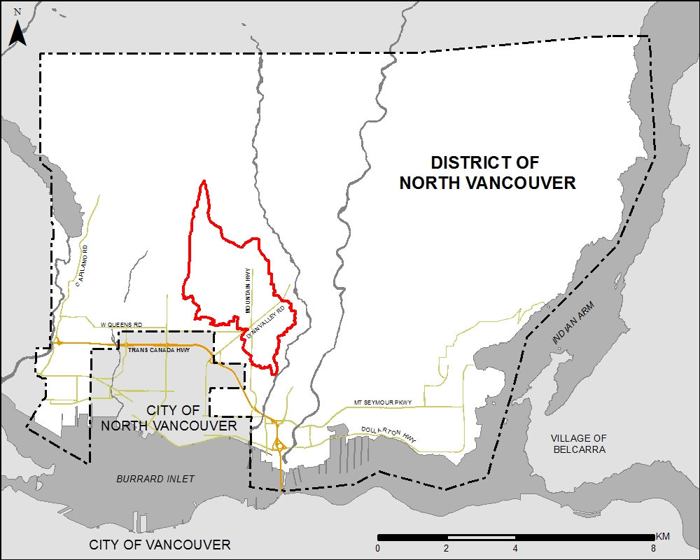
Location Map for Hastings Creek in the Lynn Valley area of North Vancouver