Inter-Governmental Partnership Rolls Out ‘Beyond the Guidebook’ at Water Balance Model Forum
Note to Reader:
While British Columbia has been experiencing enhanced social and economic well-being, it has also experienced avoidable cumulative environmental impacts, due to pressures on land and water resources.
The desire to mitigate environmental impacts has provided a driver for the ‘green infrastructure’ movement in British Columbia. This movement is water-centric, is founded on a natural systems approach, and is influencing infrastructure policies, practices and standards.
Natural Systems Approach to Rainwater Management
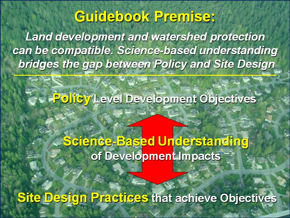
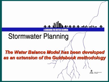
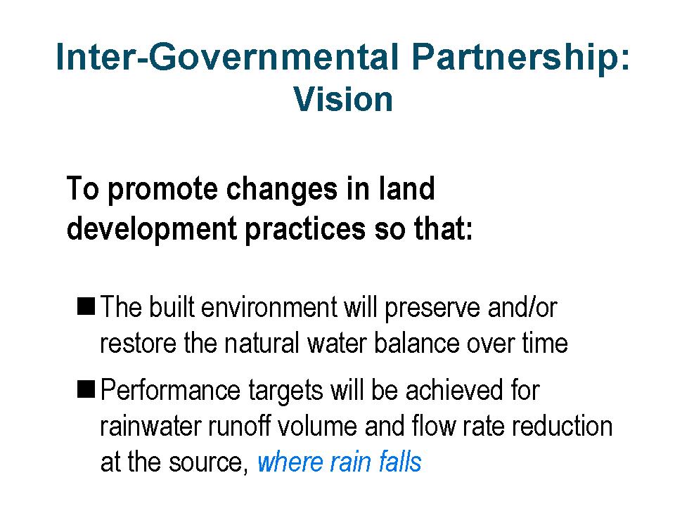
When Stormwater Planning: A Guidebook for British Columbia was published in 2002, it set in motion a chain of outcomes that has resulted in British Columbia being recognized internationally as a leader in implementing a natural systems approach to rainwater management in the urban environment. One of these outcomes was the Water Balance Model for British Columbia, an online decision support and scenario modelling tool.
A Tool of Choice
According to Ted van der Gulik (BC Ministry of Agriculture & Lands), Chair of the Inter-Governmental Partnership (IGP) that developed the Water Balance Model:
- “The Water Balance Model has emerged as the rainwater management tool of choice in making land development decisions that meet the test of being sustainable, affordable and achievable. Because it demonstrates how to achieve a light hydrologic footprint, the Water Balance Model helps practitioners wrap their minds around how to implement ‘green solutions’. Because the vision of the IGP is to promote changes in land development practices, the Water Balance Model can be described as a means to an end.”
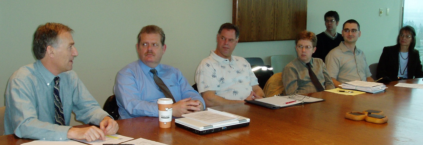
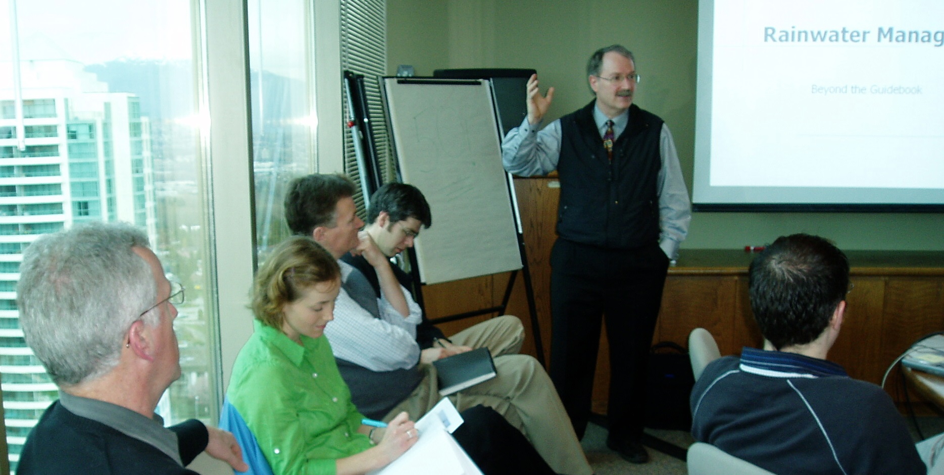
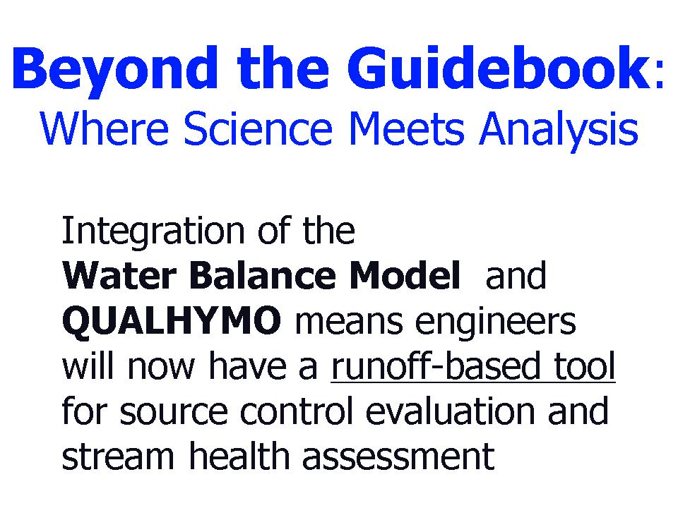
The Inter-Governmental Partnership held a Water Balance Model Partners Forum in March 2007 so that Partners could share success stories and lessons learned in implementing green infrastructure. Hosted by the Greater Vancouver Regional District, the Partners Forum also provided a timely opportunity to roll out ‘Beyond the Guidebook’, a runoff-based approach to drainage modeling that connects the dots between source control evaluation and stream health assessment.
Special guests at the Partners Forum included Liliana Bozic (City of Calgary), Chair of the Alberta Low Impact Development Partnership (ALIDP); Dr. Charles Rowney, the designated Scientific Authority for the Water Balance Model; and Linda Pechacek (from Houston, Texas), representing the Urban Water Resources Research Council.
 “Once the IGP had invited me to be a member of its Expert Advisory Panel, I decided to attend your Water Balance Model Partners Forum because I am very interested in your approach to mitigate environmental impacts associated with urbanization”, Linda Pechacek informed the Partners, “The virtual office model has facilitated a shift toward web-based design and project management tools, and the application of these new technologies relies upon the full engagement of creativity with constructive critical review. These competing strategies meld into working protocols that, at some point, translate into new models, guidelines, criteria or standards. I am looking forward to the technology transfer opportunity this interaction with British Columbia represents.”
Roundtable Sharing of Success Stories
PARTNERSHIP FRAMEWORK:
Liliana Bozic led off the roundtable sharing. She noted that the inter-provincial dialogue with British Columbia provided the catalyst for formation of ALIDP in 2004, and added that “The purpose in having an inter-provincial partnership with BC is to  collaborate and share resources in order to facilitate improvements in land development practices in both provinces. The City of Calgary, for example, is moving ahead with implementation of a ‘green street demonstration project’ that builds on the experience of the City of Vancouver and the University of BC in constructing Crown Street and Sustainability Street, respectively. We learned much by attending the Showcasing Innovation Series that was organized by your Green Infrastructure Partnership in 2006. ”
Ted van der Gulik noted that the Inter-Governmental Partnership (IGP) draws its strength from local government in British Columbia and is a consortium of local governments and regional, provincial and federal agencies. “Formed in July 2002, the IGP began as a subgroup of an inter-agency technical committee of the Greater Vancouver Regional District (GVRD). The IGP quickly expanded to become a provincial group with municipal representation from four regions of British Columbia: Greater Vancouver, the Fraser Valley, Vancouver Island and the Okanagan Valley.”
“To sustain the early success of the Water Balance Model, and to advance ‘sustainable drainage’ initiatives across Canada, the Ministry of Agriculture & Lands provided the IGP with $160,000 to expand the capabilities of the Water Balance Model by integrating it with QUALHYMO, a rainfall-runoff model developed by Dr. Charles Rowney in the early 1980s. This means engineers will be able to model the storage and routing of outflows from a subdivision and/or neighbourhood through a detention pond or down a stream channel”, added Ted van der Gulik.
CREATING CHANGE:
Laura Maclean (Environment Canada), Co-Chair of the IGP, added this context, “The experience of the Greater Vancouver region shows how important it is to have a way to bring the right people together at the right time, and in so doing  build a network that can make things happen. Looking back, much of what we have collectively accomplished in recent years in the field of rainwater management can be traced back to relationships that were formed through the GVRD’s Stormwater Interagency Liaison Group (SILG). In fact, development of the first spreadsheet version of the Water Balance Model was funded by SILG in 2001.”
“We now see a comparable relationship-building process taking shape on Vancouver Island with the formation of the inter-agency Water Balance Coordinating Team co-chaired by Jay Bradley, Ministry of Agriculture & Lands, and Chris Jensen, Ministry of Community Services. Looking ahead, the IGP anticipates that this may be the template for other regional initiatives”, observes Laura Maclean.
VANCOUVER ISLAND:
At the Partners Forum, Jay Bradley reported that “The VI Coordinating Team has been established to facilitate a consistent, science-based approach to rainwater  management on Vancouver Island. The steering committee that is providing the team with leadership comprises three provincial Ministries and the federal Department of Fisheries and Oceans (DFO). We are aligning our efforts and collaborating with DFO because we believe this will enable us to be collectively more effective in achieving desirable rainwater management outcomes. We are providing local governments and the development community on Vancouver Island with the tools and experience that will help them design with nature”
According to Jay Bradley, “The team is moving forward with an outreach program that involves meeting with local governments to generate dialogue and build bridges. The first two information sharing sessions on ‘sustainable drainage’ were hosted by the Cowichan Valley Regional District and the City of Nanaimo in December 2006 and February 2007, respectively.”

THE HYDROLOGIC FUNCTION OF SOIL AND TREES:
During the Roundtable Sharing portion of the Partners Forum, there was emphasis on the use of soil and trees to achieve beneficial rainwater management outcomes. Kim Stephens, Program Coordinator for the Water Sustainability Action Plan for British Columbia, provided a perspective for the reporting out by Partners when he commented that “For the past three years, our Water Balance Model outreach program educated municipalities and the development community about the role that the soil sponge plays in achieving integrated solutions that reduce both irrigation water use and rainwater runoff. For the next three years, we envision that the focus of our outreach will be on the role that trees play,”
 The City of Courtenay was the first BC municipality to implement a policy requiring a minimum soil depth on development sites. Sandy Pridmore reported that “Because the City places importance on the soil sponge as a rainwater management tool, we are currently exploring options to ensure that developers and house builders fulfil their obligations to provide and preserve the minimum required depth.”
One of the benefits of the Water Balance Model Partnership is networking. The City of Courtenay and City of Surrey have been sharing their lessons learned. David Hislop highlighted the City of Surrey experience in soil depth enforcement in the East Clayton Sustainable Community. David Hislop has prepared a visual complete with sound effects to illustrate the magic of dirt.
For more information on the East Clayton Sustainable Community, including the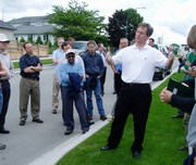 results of a performance monitoring program for rainfall infiltration, please click here to view a presentation that was made in December 2006 as part of the GVRD Sustainability Community Breakfast Series. Also, please click on Showcasing Innovation in Surrey for a related story on an event which was hosted by the City in June 2006 in collaboration with the Green Infrastructure Partnership. This involved a guided tour for Greater Vancouver municipalities, with colour commentary provided by David Hislop.
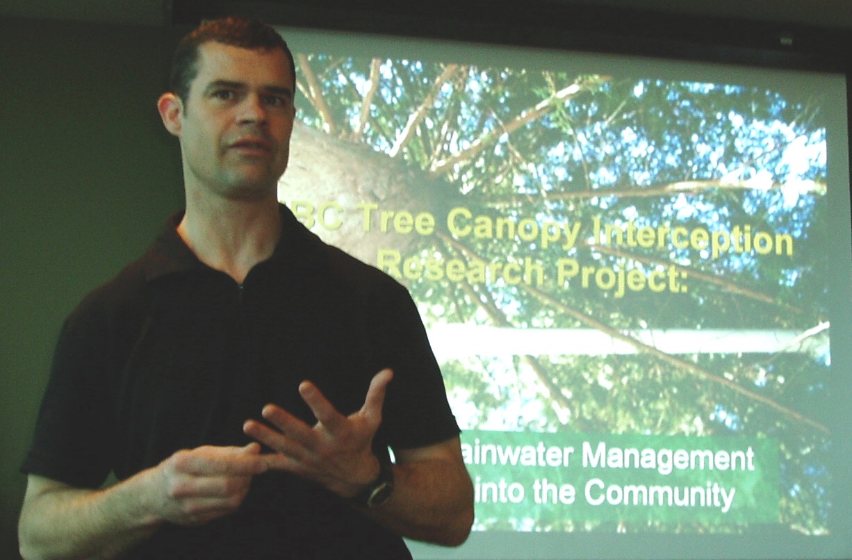
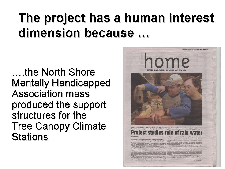
Richard Boase of the District of North Vancouver described the partnership between the University of BC and the three North Shore municipalities to implement the precedent-setting Tree Canopy Research Project. “While considerable research has been done in the natural environment, very little has been in an urban setting anywhere in North America. We have installed 60 tree canopy climate stations across the North Shore. One of our research interests is to determine the effectiveness of a single tree versus that of a cluster of trees. The research results will be used to populate the Tree Canopy Module in the Water Balance Model.”

According to Richard Boase, “This project has opened the door to a long-term partnership with UBC to bring science into the community. There is also broad-based community participation. We have engaged the North Shore Mentally Handicapped Association to mass produce the wooden support structures for the tree canopy climate stations. We have engaged community volunteers in neighbourhoods such as Clovelly-Caulfeild in West Vancouver. At the end of the day, the project will enable communities to make informed planning decisions about designing with nature.”
To view Richard’s presentation, please click on this link to The Story of the UBC Tree Canopy Interception Research Project
LANDSCAPE-BASED SOLUTIONS:
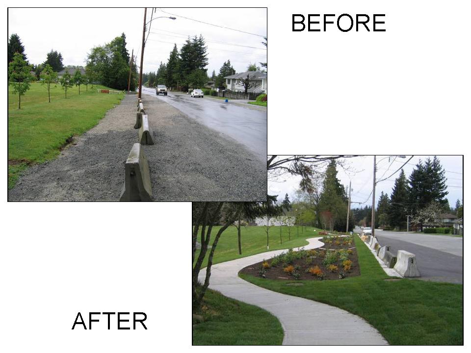
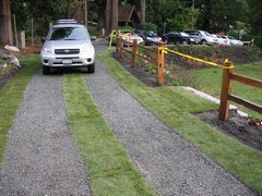
![]() Sarah Howie showed examples of rain gardens and infiltration swales to illustrate how the Municipality of Delta is implementing landscape-based solutions that solve drainage issues and create community amenities. The before and after photos below illustrate the filling of a roadside ditch with an Atlantis Rain Tank system and the completed project on 86th Avenue in Delta.
Sarah Howie showed examples of rain gardens and infiltration swales to illustrate how the Municipality of Delta is implementing landscape-based solutions that solve drainage issues and create community amenities. The before and after photos below illustrate the filling of a roadside ditch with an Atlantis Rain Tank system and the completed project on 86th Avenue in Delta.
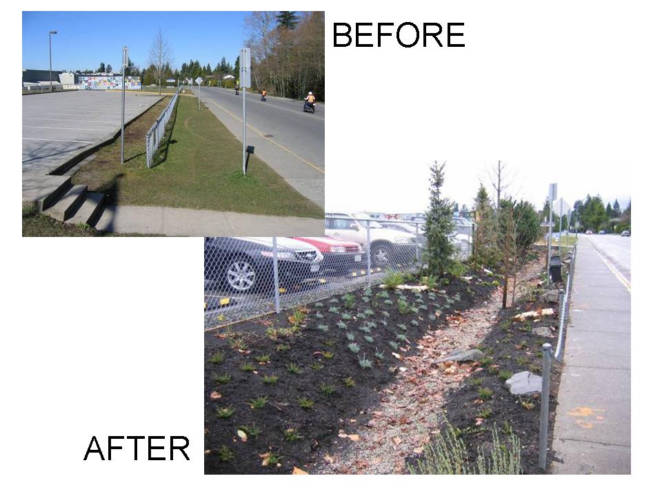
Shown above are before and after photos for a parking lot rain garden constructed in Summer 2006 at Cougar Canyon Elementary School in Delta. For details of these and other projects, please click on this link to Implementation of Green Infrastructure in Delta
Another Water Balance Model Partner that is investing a major effort in landscape-based solutions is the City of Kelowna. For information on what the City is doing, please click on this link to Kelowna’s Water Conservation Experience The focus of  the presentation by the City’s Don Degen at the Building SustainAble Communities Conference was on what level of water saving can be achieved through landscaped-based measures such as soil amendments and irrigation system improvements. The other benefit of soil depth plus amendment is reduced rainwater runoff.
ESTABLISHING REGIONAL PRECEDENTS:
The experience of the City of Vancouver demonstrates that someone has to ‘build the first one’ so that others  will follow. Crown Street and Country Lanes have established regional precedents that other municipalities are now replicating. Both were featured in the Showcasing Innovation Series organized by the Green Infrastructure Partnership in 2006. For the complete story, please click on this link to Showcasing Innovation in the City of Vancouver. “The first year of performance monitoring for Crown Street has been completed and the results will be released shortly. I can confirm that the infiltration system is performing as expected”, Andrew Ling reported at the Partners Forum.
The East Fraser Lands project for a community of 10,000 along the north bank of  the Fraser River within the City of Vancouver is a case study for “Beyond the Guidebook”. The project is applying a design with nature approach that advances the state-of-the-practice in rainwater management by doing something on each roadway to achieve a rainwater management outcome. Innovative rainwater management systems will turn rainwater into a resource and enhance the quality of rainwater before it is released to the Fraser River ecosystem. The project also involves an innovative application of the Water Balance Model to support technical decision-making.
 “The City of Vancouver’s Country Lanes provided the inspiration for West Vancouver’s first green lane adjacent to St. Francis in the Woods Church in historic Lower Caulfeild”, noted Saleem Mahmood of the District of West Vancouver.
DEVELOP WITH CARE:
The March 2006 version of Develop with Care replaces the previous versions (June 2004 and April 2005) of Environmental Best Management Practices for Urban and Rural Land Development in British Columbia.
According to Peter Law of the Ministry of Environment, “This document is intended to assist people who are involved in planning, implementing, reviewing and/or approving land developments in British Columbia’s urban and rural areas. Its primary purpose is to provide province-wide guidelines for the maintenance of environmental values during the development of urban and rural lands. It also provides information on ways that environmental protection and stewardship can benefit the community, the property owner and the developer, as well as the natural environment.”
“Develop with Care includes many ideas and suggestions on ways to achieve ‘cleaner, greener’ developments and provides information on ways that environmental protection and stewardship can benefit the community, the property owner, and the developer, as well as the natural environment. Decisions related to urban and rural land development in this province are shared by many; therefore, this document is intended to support and encourage good decision making by all those involved in land development in British Columbia. Develop with Care emphasizes the use of the Water Balance Model to achieve desired rainwater management outcomes”, concluded Peter Law.
Building on Experience
When Stormwater Planning: A Guidebook for British Columbia was published in 2002, it established the framework for rainfall capture and a performance target way-of-thinking and designing. “The concepts and methodologies in the Guidebook were intended to stimulate a change in the mindset of practitioners and others, rather than cast in stone a set of prescriptive rules”, reported Peter Law, Chair of the inter-governmental Steering Committee that was responsible for Guidebook development.
“Five years later, a goal of the Inter-Government Partnership is to build on the Guidebook foundation by providing practitioners with the tools and experience they will need to advance the state-of-the-practice in rainwater management”, continued Laura Maclean, who co-chaired the Guidebook Steering Committee.
 “To benefit from lessons learned on-the-ground over the last five years, the Water Balance Model Partnership began the rollout of an initiative called Beyond the Guidebook in mid-2006”, added Kim Stephens (Program Coordinator, Water Sustainability Action Plan for British Columbia) informed attendees at the Partners Forum, “The purpose of this initiative is to help local governments and the development community establish what level of rainwater runoff volume reduction makes sense at the site, catchment and watershed scales.”
“Beyond the Guidebook will take the Guidebook innovation to the next level of evolution”, Stephens continued, “Now that practitioners are becoming comfortable with what ‘rainfall capture’ means in practice, local governments and the development community are in a position to turn their attention to what is an achievable outcome that makes sense and results in a net environmental benefit.”

Fergus Creek Pilot Watershed Plan
“The pilot for Beyond the Guidebook is the Fergus Creek watershed plan that the City of Surrey has recently completed. The Fergus Creek plan demonstrates how to protect stream health in the urban environment”, noted David Hislop, City of Surrey representative on the Water Balance Model steering committee.
In commenting on the significance of the Fergus Creek plan as the pilot for Beyond the Guidebook, Kim Stephens observed that the plan is based entirely on implementing ‘green solutions’ as an alternative to conventional engineered ‘blue solutions’, and predicted that Fergus Creek will soon be attracting considerable attention from around North America because of the City’s fundamental shift in approach to rainwater management.
“That’s right”, continued David Hislop, “In addition to rainwater capture on individual lots, the strategy for replicating natural infiltration processes includes creation of contiguous large-scale green corridors through the watershed. Besides obvious environmental benefits the City has concluded that the corridors can result in cost savings for developers (and ultimately homebuyers) and the City because their effectiveness at controlling rainfall volumes makes the traditional detention pond redundant.” To learn more about the Fergus Creek plan, please click here.
Kim Stephens also informed the Partners Forum that: “The Department of Fisheries and Oceans (DFO) is a partner in the Beyond the Guidebook process, in part because this runoff-based approach is intended to resolve performance concerns that we believe have arisen due to misapplication of the so-called DFO Guidelines.” His reference was to a 4-page document originally released by DFO in 2000 and titled Urban Stormwater Guidelines and Best Management Practices for Protection of Fish and Fish Habitat. This frame-of-reference provided the segue for a detailed presentation by Jim Dumont on the Beyond the Guidebook methodology.
Beyond the Guidebook Overview by Jim Dumont
Jim Dumont is the senior water resources specialist who is responsible for development of the stream health application that is at the heart of the Water Balance Model powered by QUALHYMO.  “The rainwater management issue in a nutshell is that people want to have their cake and eat it too…because they want development, yet they want to avoid the types of in-stream environmental impacts that have historically resulted from changing the surrounding landscape through urbanization. So how do we reconcile this challenge”, stated Jim Dumont. “Well, we start by examining the criteria that have driven stormwater and rainwater management practice in British Columbia for the past 15 years. The current era as we know it began with the 1992 Land Guidebook Guidelines. To understand where we are going, you have to first understand where we have come from”, he continued.

Plan at Four Scales: The Guidebook provides guidance for planning at four scales: regional, watershed, neighbourhood and site. It presents a methodology for identifying at-risk drainage catchments to focus priority action. The methodology relies on a roundtable process that brings people together with knowledge about future land use change, high-value ecological resources and chronic flooding problems. It also presents a methodology for developing watershed performance targets, and for translating these targets into design guidelines that can be applied at the site level to mitigate the impacts of land development. According to Jim Dumont, “The lasting impact of the Guidebook is that it changed how people view site development practices, and it got them thinking about how to change those practices for the better.”
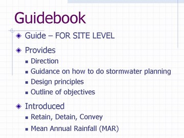
Guidebook Innovation: “In 2002, the Guidebook made two valuable contributions in advancing rainwater management practice”, noted Dumont, “First, it introduced the concept of the Integrated Strategy for management of the complete rainfall spectrum. This strategy, which was unique to BC when introduced, boils down to three words: retain, detain and convey. Retain means keep the light showers on site through ‘rainfall capture’ measures such as rain gardens and soakaways. Detain refers to the use of detention ponds to provide ‘runoff control’ which reduces peak rates of runoff during periods of heavy rain. Convey means reduce flooding by producing sufficient hydraulic capacity to contain floodflows during extreme storms.”
“The Guidebook also introduced the concept of the Mean Annual Rainfall, or MAR, to provide consistency with the 1992 Land Development Guidelines which focus on managing runoff events with a 2-year return period”, added Dumont, “Kim Stephens, the Guidebook author, tells me that he developed the MAR concept to establish what he calls a ‘point of departure’ that would appear familiar to drainage engineers so that they would readily make the transition to a new way of thinking. Because the 2-year return period could be conceptually equated to the MAR, drainage engineers could intuitively understand the MAR and therefore readily accept it.”
Application of DFO Guidelines: The so-called ‘DFO Guidelines’ were developed on a parallel track to the Guidebook, and reflected inter-agency discussions that were taking place at the time. This 4-page ‘Draft Discussion Document’ represented an initial attempt by DFO to succinctly capture contemporary thinking about criteria that would achieve runoff reduction through infiltration of the more frequent runoff events. The Water Balance Methodology that is at the heart of the Guidebook drew heavily on case study experience by those who pioneered implementation of source controls on-the-ground in British Columbia, notably the City of Chilliwack and UniverCity on Burnaby Mountain. The DFO Guidelines informed this case study experience.
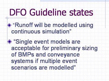
According to Jim Dumont, “My experience is that you have to understand what was in a person’s mind when they developed a set of criteria. To achieve that, it invariably helps if you go back to the source document. As the years have passed, my observation is that the DFO Guidelines may not be accurately portrayed. I believe this is resulting in them being misapplied without full consideration of the ultimate consequences or regard to performance of proposed works. The DFO Guidelines are very clear in specifying continuous simulation modeling, yet the use of design storms has become prevalent practice. The Beyond the Guidebook program therefore creates the opportunity to get our collective thinking back on the right track so that the unintended consequences of design storm applications are prevented.”

A New View: “When we use the phrase Beyond the Guidebook, we are essentially saying this is ‘where science meets analysis’… because the science-based analytical methodology that we have validated through the Fergus Creek pilot now enables local governments to explore the fundamental requirements implicit in the DFO Guidelines for stream health and environmental protection. We are at a crossroad in the path defining the methodologies and applications used in rainwater management. In a nutshell, Beyond the Guidebook enables us to make a clear distinction between a rainfall-based approach and a runoff-based approach”, continued Jim Dumont.

According to Jim Dumont, “A basic tenet of hydrology is that rainfall and runoff have different return periods. Yet drainage practitioners persist in applying a rainfall-based approach that assumes rainfall will always result in the same magnitude of runoff.” The Rainfall-Based Approach grew out of simple to use methodologies that address the reduction of flood risk for drainage conveyance systems. The Runoff-Based Approach, on the other hand, leads to the analysis of runoff and its interaction with the physical aspects considered important to the aquatic environment.

Modelling Approach: A primary benefit of the Runoff-Based Approach is the use of continuous simulation using long-term records to calculate runoff means that the frequencies and durations of various conditions can be estimated easily. The performance of rainfall capture and runoff control facilities for volume and flow rate reduction depends not only on the rainfall volume and temporal distribution, but also on antecedent conditions such as soil moisture and the volumes of existing water retained in ponds from previous storms. All of these factors overlie the physical characteristics of a site or watershed in terms of vegetative cover, imperviousness, connectivity, slope, and the many defining parameters describing the condition of the soils. The use of continuous simulation allows a direct observation of the frequency of the condition of interest from the results of the calibrated models, and therefore accounts for the effect of joint probabilities of occurrence of the large number of variables.
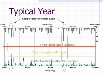
The hydrograph for a ‘typical year’ underscores the variable response of a watershed to rainfall. Two events are highlighted. The larger of the two rainfall events resulted in much less runoff. As can be seen from the hydrograph, the small of the two rainfall events was preceded by a period of wet weather such that more runoff resulted. The hydrograph also shows that 90 percent of the total annual runoff volume corresponds to a very small runoff rate.
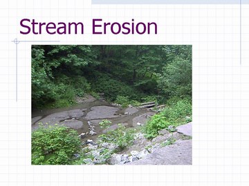
Stream Erosion: Continuous simulation results can be used to determine the durations of depth and velocity in streams along with the amount of aquatic habitat available over time. The results can also be extended into an assessment of the energy available to cause erosion and transform the physical characteristics of a stream. We now have the basic components to begin integrating the engineering with the environmental aspects relating to aquatic environments. According to Jim Dumont, “This will allow us to create an understanding of how we affect the environment and to mitigate those impacts. We will be able to clearly define relationships between rainfall, runoff, habitat availability, erosion forces and geomorphology of streams. On this path there is an opportunity to integrate the wisdom gleaned from many areas of knowledge.”
“Hydrological engineers see the need for both runoff and rainfall based approaches; they can be complementary”, emphasized Jim Dumont, “The runoff-based approach is best suited to the analysis needed to assess environmental impacts and effectiveness of mitigation techniques. Within this an underlying need to focus on the small runoff events that can overwhelm fragile environmental systems. Flood protection measures, on the other hand, can and should be designed with reference to extreme events using established rainfall-based approaches.”

Water Balance Model powered by QUALHYMO: The principal focus of the existing Water Balance Model is on source controls for runoff volume reduction. For drainage engineers, however, a practical modelling tool must also concentrate on the overflows from the site. This is the significance of having the capability to store and route the overflow from a subdivision and/or neighbourhood through a detention pond or down a stream channel. The Water Balance Model powered by QUALHYMO will enable assessment of source control performance plus model the overflows once source controls have reached capacity. “This integrated tool provides the ‘one-stop shopping’ that will enable hydrological engineers to go Beyond the Guidebook in achieving stream health protection and water quality objectives”, stated Jim Dumont.
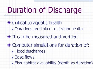
As explained by Jim Dumont at the Water Balance Model Partners Forum: “A critical factor in the health of a stream is the duration of flow or, as viewed slightly differently, the amount of time that the discharge would exceed critical values. While there are a number of critical discharge values for any specific stream reach, an assessment can be undertaken to compare a range of values. In this manner the effects of altered hydrologic regimes can be evaluated along with a possible range of possible mitigation options. This enables application of a performance target approach that is akin to the way the WBM is currently used.”
Performance Targets
 The Guidebook pioneered the application of performance targets to rainwater management, and the Water Balance Model enables users to test their achievability. For a performance target to be implemented and effective, it must be quantifiable. It must also have a feedback loop so that adjustments and course corrections can be made over time. To be understood and effective, a performance target needs to synthesize complexity into a single number that is simple to understand and achieve, yet is comprehensive in scope. A runoff volume-based performance target fulfills these criteria.
As explained by Peter Law of the Ministry of Environment, “When we wrote the Guidebook, we recognized there is a material difference in the characterization of surface runoff that originates from an individual development site versus flow that you see at a catchment or watershed scale. What you see in a watercourse is the total flow – that is, water that flows overland plus water that moves through soil until it daylights. This is one reason why Chapter 6 in the Guidebook emphasizes the need for flexibility in setting performance targets, and states that performance targets should be customized for individual watersheds and catchments, based on what is effective and affordable in the context of watershed-specific conditions.”
The output from the current version of the Water Balance Model is ‘surface runoff’, whereas the output from the Water Balance Model powered by QUALHYMO will be ‘total flow’. This expanded capability is a key to determining what level of rainfall capture may be effective and affordable. “It is important for everyone to keep in mind that the application of a performance target approach is essentially about due diligence and doing the right things to capture rain where it falls. The performance target approach is intended to be the exact opposite of a prescriptive approach. The latter is counter-productive when it leads to rigid standards that have the effect of inhibiting creativity and innovation”, added Peter Law.
The First Paradigm-Shift
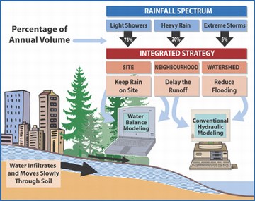
In 2002, the purpose in introducing performance targets for rainfall capture was to facilitate implementation of the Integrated Strategy for managing the complete rainfall spectrum. To create a mind-map for practitioners, the rainfall spectrum was defined in terms of three tiers, with each tier corresponding to a component of the integrated strategy, namely: light showers, heavy rain, and extreme storms.
Defining rainfall tiers enabled a systematic approach to data processing and identification of rainfall patterns, distributions and frequencies. Establishing the Mean Annual Rainfall (MAR) as a reference point provided a convenient way to divide the total number of rainfall-days per year into three groupings. The relevance of the MAR is simply that it established a starting point for assessing the achievability of rainfall capture. In 2002, focussing on the MAR facilitated a paradigm-shift in the state-of-the-practice because it demonstrated that rainfall capture was achievable: the number of rainfall-days up to and including the MAR equated to 90% of the total annual rainfall volume.

The Next Paradigm-Shift
According to Ted van der Gulik, “The Inter-Governmental Partnership envisions the next paradigm-shift in the state-of-the-practice will revolve around the way we relate runoff volume management to stream erosion and water quality. Volume is something that local government has control over, and it is measurable. We have observed that the power of the Water Balance Model process lies in the conversations that result from users generating a single number – the percentage of rainfall that becomes runoff – that represents the synthesis of any particular scenario. Comparison of scenarios creates understanding, especially when the focus is on the hydrologic implications of the assumptions that underpin those percentages.”
“Several qualitative indicators can be utilized in assessing the potential for erosion or sediment accumulation within a watershed”, elaborated Jim Dumont, “The methodology selected for the Water Balance Model powered by QUALHYMO is based upon shear stress as applied to the stream banks over time. This is a measure of the energy available to cause erosion in a stream. Continuous simulation is the key to generating scenario comparisons. ”

“Normal sediment loading from a stable urban watershed is in the range of 0.10 to 0.61 tonnes per year per hectare of watershed. It is therefore normal and expected that a stream will carry some sediment on a regular basis. Because sediment transport is a natural process, it should not be disrupted without anticipating some consequences. So, when simulating the build-up and wash-off of sediment and first-order decay contaminants from a watershed, the general objective is to identify what combination of rainfall capture measures will maintain a natural level of annual suspended sediment loading”, explained Jim Dumont.
Implementation
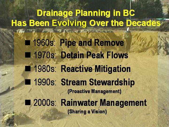
In his closing remarks at the Partners Forum, Ted van der Gulik provided this perspective: “Drainage planning has been evolving over the decades. We used to refer to stormwater management because the objective was to manage a handful of extreme rainstorms. Now we use the term rainwater management because it is all-encompassing. Looking back only a few years, it is amazing how little we really understood about the rainfall-runoff process.”
“At this Partners Forum, you learned about the fundamental differences between rainfall-based thinking and runoff-based thinking, and what the implications mean for an environmental protection strategy. Because the runoff-based approach holds the key to assessing environmental impacts in watercourses and the effectiveness of mitigation techniques, integration of the Water Balance Model and QUALHYMO means local governments will now have a runoff-based tool for source control evaluation and stream health assessment.”
“While the beta-testing is underway over the next six months, the leadership of the Inter-Governmental Partnership urges the Water Balance Model Partners to identify exactly how they will implement Beyond the Guidebook in their municipalities.”