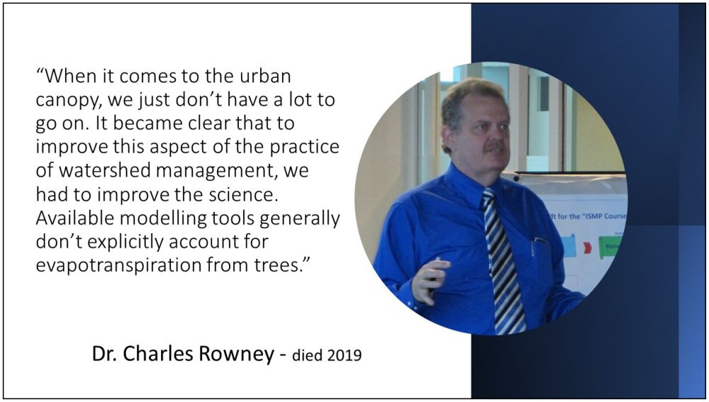
FLASHBACK TO 2012: “Given the huge knowledge bases that the sciences have built up around the hydrology of urban watersheds, it can come as a surprise when we realize how little is known about some of the basics. The urban tree canopy is an example,” stated (the late) Dr. Charles Rowney, Scientific Authority, when the Partnership for Water Sustainability announced the addition of a Tree Canopy Module to the Water Balance Model
Note to Reader:
In 2005, the District of North Vancouver initiated a precedent-setting initiative in partnership with the University of British Columbia (UBC). By the beginning of 2007, a network of 60 “tree canopy climate stations” was in place across the North Shore region of Metro Vancouver. The research findings were published in a Master’s thesis by Yeganeh Asadian dated April 2010. The research informed development of the Tree Canopy Module in the Water Balance Model. The latter was funded by the governments of Canada and British Columbia under the Regional Adaptation Collaboratives (RAC) Program.
To download a PDF version of the announcement by the British Columbia Partnership for Water Sustainability in May 2012, click on Rebuilt Water Balance Model Now Incorporates Tree Canopy Module. This document serves as a Primer for the context, the research, and the tool.
The Goal: Bridge a Knowledge-Gap
“Given the huge knowledge bases that the sciences have built up around the hydrology of urban watersheds, it can come as a surprise when we realize how little is known about some of the basics. The urban tree canopy is an example,” stated (the late) Dr. Charles Rowney, Scientific Authority for the Water Balance Model Partnership, in a 2012 statement.
“Tree canopy interception of rainfall is a technical area where the fundamentals are well understood, but the empirical basis, the availability of actual observations, is still in its infancy. When it comes to the urban canopy, we just don’t have a lot to go on. Considering the importance of urban trees, we’re not sure why this knowledge gap has persisted. But when we began our research, it quickly became clear that there is a lot to learn about some of things that are important in dealing with the tree canopy.”
“And it became just as clear that to improve this aspect of the practice of watershed management, we had to improve the science. Available modelling tools generally don’t explicitly account for evapotranspiration from trees.”
The Right Trees in the Right Places
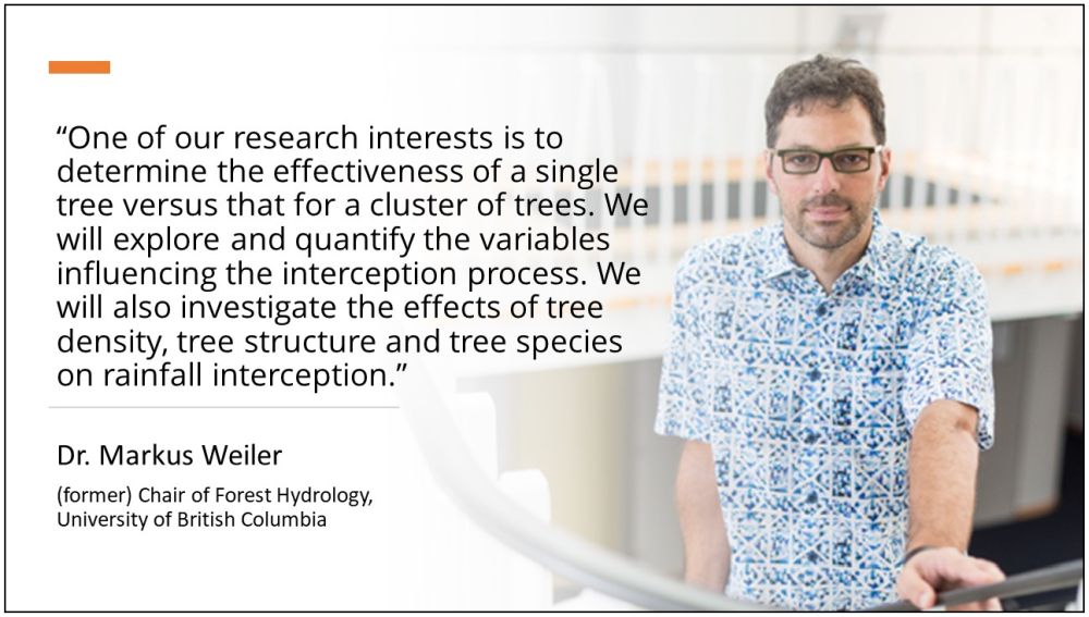
When the field research was initiated, Dr. Markus Weiler, former Chair of Forest Hydrology at UBC provided this context: “While considerable research has been undertaken in forest stands in the natural environment, very little has been done in an urban setting anywhere in North America.” Dr. Weiler and Dr. Hans Schreier developed the project approach and the system for measuring rainfall interception by the tree canopy.
Dr. Weiler postulated that: “In theory, it is highly probable that interception losses of a tree that stands in an urban setting is larger compared to a tree within a forest stand. There may be even an optimum of tree density and structure whereby the interception is largest for a certain tree density. If this density can be determined, or even the relation of tree density to interception loss, local governments could provide urban developers with guidance as to how many trees need to be maintained within a residential lot to maintain a certain interception effect.”
To Learn More:
Download a copy of a presentation that provides an overview of the project scope: The Story of the UBC Tree Canopy Interception Research Project.
Explore the historical resources accessible at North Shore Tree Canopy Interception Research Project.

How the Research Has Been Translated Into a Practical Tool
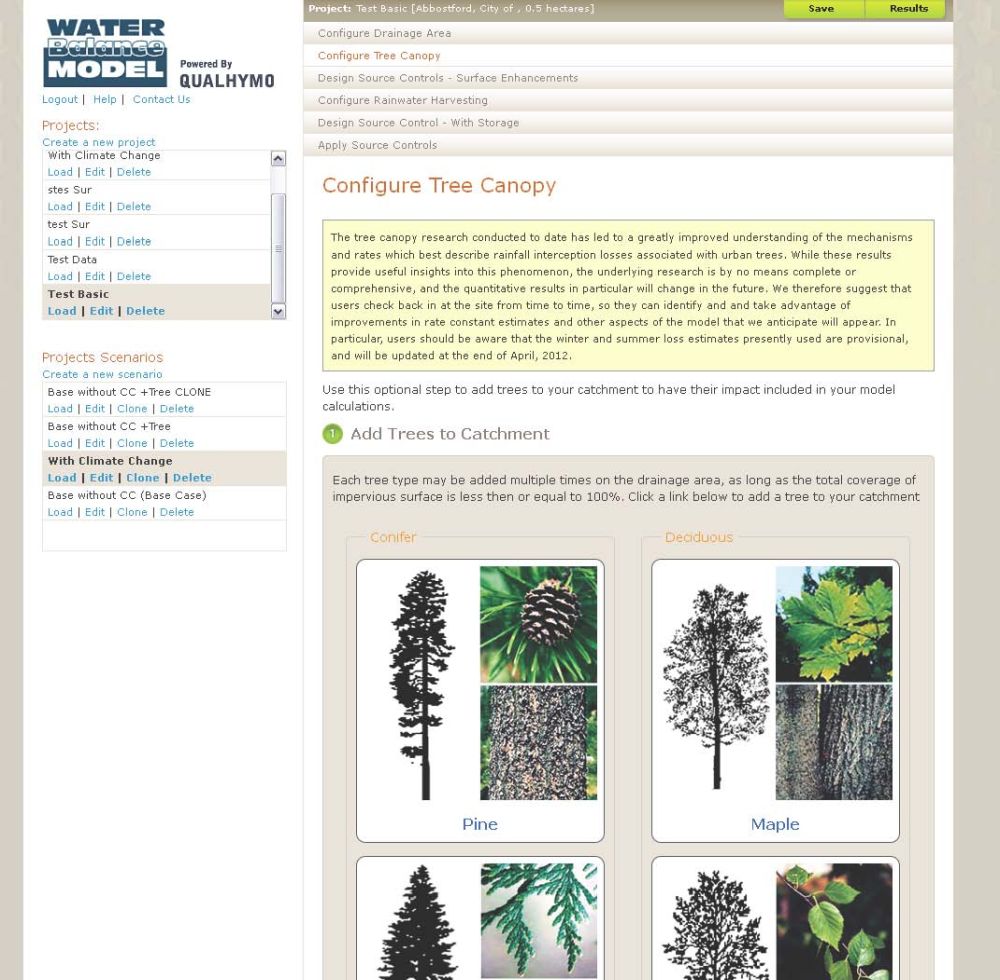
Accompanying the physical explorations was research to develop a practical model of the canopy capture processes that were being measured. “Because it has been built into the QUALHYMO calculation engine as a new computational module, the net result of this program is to provide the Water Balance Model with a solid capability to represent isolated or clustered trees in the urban environment,” reported Dr. Rowney.
“Because of the way the code was developed, a wide range of urban species can potentially be dealt with, including hedge rows, ground cover or other characteristics that may be of interest. For the present, the basic data deal with these species as evergreens or deciduous species because the data don’t justify subdividing the content further.”
“Of course, the code can be updated and expanded as well when and if new understanding of the processes emerges, but in the mean time, the model is robust, effective and easily expanded. That is an outstanding first step in the ability to represent and usefully model the effect of trees on urban hydrology,” concluded Dr. Rowney.
To Learn More:
To download a PDF version of the Announcement by the British Columbia Partnership, click on Rebuilt Water Balance Model Now Incorporates Tree Canopy Module.