Cowichan Water Balance Model Forum features case study applications at three scales: watershed, neighbourhood and site

Living Water Smart – Doing Business Differently in British Columbia
Published in June 2008, Living Water Smart is the provincial government’s vision and plan to keep British Columbia’s water healthy and secure for the future. Through this plan, the Province commits to new actions and targets – and builds on existing efforts to protect and keep our water safe.
Protect Stream Health
By 2012, all land and water managers will know what makes a stream healthy, and therefore be able to help land and water users factor in new approaches to securing stream health and the full range of stream benefits.
- What does this mean to those involved in land development or redevelopment?
The Province and local government are collaborating to develop a suite of user-friendly tools and approaches for assessment purposes and to provide consistency when reviewing development applications.
The web-based Water Balance Model for British Columbia (WBM) is one of these tools.

Cowichan Valley Water Balance Model Forum: how to achieve the vision
On October 17, the Cowichan Valley Regional District (CVRD) is hosting a ‘by invitation only’ Water Balance Model Forum in collaboration with the Inter-Governmental Partnership.
The Forum is organized under the umbrella of CAVI – Convening for Action on Vancouver Island. The Forum will feature a roundtable sharing of case study experience related to achieving runoff-based performance targets.
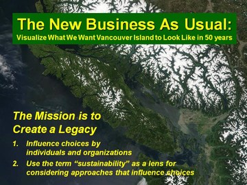
The Cowichan Valley Water Balance Model Forum is part of the implementation for Beyond the Guidebook: The New Business As Usual. A goal of the Forum is to advance a common understanding and consistent messaging regarding on-the-ground expectations for rainwater management and green infrastructure.
Create Liveable Communities & Protect Stream Health
This provincial initiative builds on the foundation provided by Stormwater Planning: A Guidebook for British Columbia, published in 2002, and incorporates lessons learned over the past six years in moving from planning to action.
“Too often technical people jump prematurely into the details, make technical  analyses unnecessarily complex, and solve the wrong problem. Thus, an over-arching message is: pause, step back and define the problem first,” observes Kim Stephens, Forum moderator and Program Coordinator for the Water Sustainability Action Plan for British Columbia. “The Water Balance Model helps us solve the right problem. The desired outcome is to create liveable communities and protect stream health.”
Kim Stephens was project manager and principal author of the Guidebook. This transformational document set in motion a chain of outcomes that has resulted in British Columbia being recognized internationally as a leader in implementing a natural systems approach to rainwater management in the urban environment.

Water Balance Model Case Study Applications
Willing owners/developers and their planning/design consultants are collaborating with the Water Balance Model team to develop three case study applications that will be shared at the Forum. The purpose of the case study applications is to demonstrate that the Water Balance Model:
- can be applied at all scales of land use;
- places the emphasis on what is important;
- provides a consistent approach;
- generates reliable numbers easily and quickly; and
- informs land development strategies.
 The case study applications are at three scales: watershed, neighbourhood and site. “These will provide the technical foundation for roundtable sharing, exploration and cross-fertilization of ideas on how to implement green infrastructure effectively,” notes Kate Miller (CVRD Environment Manager), Chair of the Cowichan Valley Organizing Team.
Introduction to the Three Case Studies
 “What is unique about our approach is the educational context. Willing project proponents have volunteered to develop and share the case studies,” states Rob Conway, Assistant Manager, CVRD Development Services. “It truly is a collaborative effort.”
Prior to the Forum, the Water Balance Model will be applied to these three projects so that the results will inform the Forum learning outcomes:
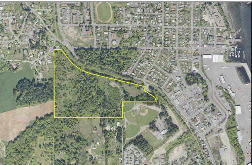
- Watershed-scale:Bamberton Lands, a project by Three Point Properties
- Neighbourhood-scale:Artisan Village (Chemainus), a project by Chris Clement
- Site-scale: Lanes Landing (Cowichan Bay), a project by Len Barrie

Bamberton Lands
“The Bamberton Lands consist of 1580 acres of land with 5km of oceanfront along the Saanich Inlet,” reports Michelle Mahovlich of Three Point Properties. “It operated as a cement plant for 70 years. The site was abandoned in 1981 following the cement plant closure.”
“Upon its purchase in 2005, Three Point Properties spent the next two years remediating the property and formulating a revitalization plan,” continues Michelle Mahovlich. “The property is currently in a rezoning process with the CVRD. Plans for the site include three comprehensive development zones of residential, commercial, eco-industrial and marine industrial land and dedication of 65% of the property for parks and open spaces.”
“The residential areas consist of up to 3,227 units, with one-third single family, one-third condo and one-third townhome,” concludes Michelle Mahovlich. “The project proposes to attain LEED Platinum for Neighbourhoods status using the Dockside Green development as a template for the Bamberton site, including the design with nature rainwater/stormwater systems.”
Artisan Village
Artisan Village
The Artisan Village property has significant historical ties to the Chemainus community, including the Hermit Trails, which were donated to the community in the late 80’s and remain a popular well-used amenity. This site was the location of the original “Artisans Village”, planned as an international campus intended to accommodate artists and artisans from around the Pacific Rim.
“The Vision is to create a unique mixed-use neighbourhood utilizing open space, quality architecture, and the site’s natural beauty,” explains Dave Conway of Creative Engineering, the civil engineering/rainwater management member of the consulting team.
“The proposed development will create a safe, pedestrian-oriented neighbourhood that provides amenities for both the residents and the larger community,” continues Dave Conway. “The spirit of Artisans Village will be kept alive with the incorporation of a small welcoming live-work development at the eastern side of the property.”

Artisan Village – development vision
“We are working with the District of North Cowichan to establish performance targets consistent with Environmental Best Management Practices and implement what can be practically achieved based upon the site terrain and conditions,” adds Dave Conway. “An inventory of the existing landforms, soils and drainage conditions will form the background for a rainwater/ stormwater management plan to guide the development so that it achieves the goal of having no adverse impact on Askew Creek, adjacent properties or downstream drainage facilities.”
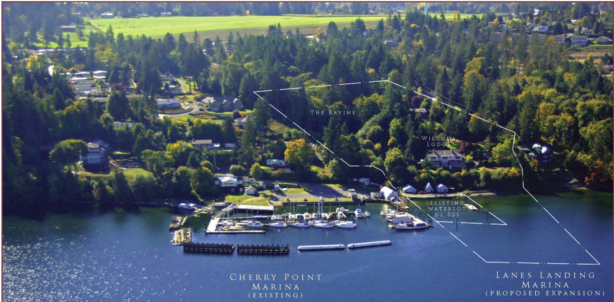
Lanes Landing – view from the water
Lanes Landing
“The proposed Lanes Landing development proposes a total of 70 units composed of 9 clustered cottage town homes, 2 duplex cottages, 2 duplex ravine stilt homes and the relocation, restoration and expansion of the existing Wilcuma Lodge building,” explains Shaun McIntyre of Merrick Architecture, the project team leader.
“The site is characterized by its steep natural grade, spectacular water views, and a natural ravine along the east property line, which occupies a third of the site’s total area,” continues Shaun McIntyre. “There is no required setback from top of the ravine bank, facilitating a more comprehensive development plan.”
“Rainwater management is being addressed by a combination of green roofs plus a number of different methods of permeable paving,” concludes Shaun McIntyre. “The Water Balance Model case study application provides us with an opportunity to quantify the rainwater runoff volume reduction that will result from our proposed rainwater management innovation.”

What is the Water Balance Model?
The new ‘Water Balance Model powered by QUALHYMO’ is unique, bridges engineering and planning, links development sites to the stream and watershed, and enables local governments to establish science-based runoff performance targets.
Further, the WBM enables experienced users to correlate green infrastructure effectiveness in protecting stream health.
“Web-based and public domain, the  WBM is available to any and all at www.waterbalance.ca,” states Ted van der Gulik (Ministry of Agriculture & Lands), Chair of the Inter-Governmental Partnership that developed the Water Balance Model.
“This tool is the computational and communication backbone that will take British Columbia towards the sustainable reality of a greening of the built environment.”
To Learn More:
Click on the following link to an article in the April 2008 issue of Runoff: Create Liveable Communities and Protect Stream Health: Water Balance Model powered by QUALHYMO integrates the site with the watershed and the stream.