
Georgia Basin IREI: "Everyone learns about the water balance (water cycle) in elementary school, but most have forgotten by high school," stated Kim Stephens in a lecture to landscape architect students at UBC (Nov 2016)
Note to Reader:
 In November 2016, Kim Stephens (Executive Director, Partnership for Water Sustainability in BC) delivered a lecture at the University of British Columbia as part of the curriculum for a Master’s level design course taught by Daniel Roehr, an Associate Professor in the Landscape Architecture & Environmental Design Program.
Since 2007, Daniel Roehr has run the research group Greenskins Lab at UBC which investigates the effciency of green roofs as an integral part of a storm water mitigation strategy that also includes green façades and green streets.
Guiding Principles for Protecting and/or Restoring the Water Balance
“My interest in contributing to Daniel Roehr’s course was two-fold,” stated Kim Stephens.
 “First, it was an opportunity to inform his students about the relevance and value of the Primer on Application of Ecosystem-based Understanding, released by the Partnership for Water Sustainability in September 2016. In short, the lecture was part of the ongoing roll-out of the Primer.”
“Secondly, it allowed me to share why and where British Columbia is heading with an approach that we are branding as Sustainable Watershed Systems, through Asset Management.”
“My lecture had three modules. In the one that I labelled Water Balance 101, I introduced Daniel’s class to set of guiding principles for integrating water balance principles into the site development decision process.”
“Get it right at the development scale and the results will accumulate at the watershed and regional scales.”
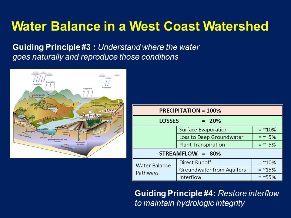
Water Balance Principles
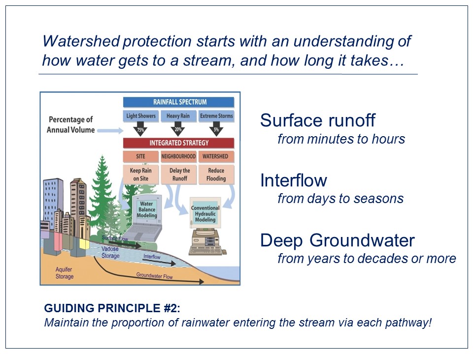
- Manage all the rainfall days in a year
- Maintain the proportion of rainwater entering the stream via each pathway
- Understand where the water goes naturally and reproduce those conditions.
- Restore interflow to maintain hydrologic integrity.
- Replicate the flow-duration pattern to mimic the Water Balance.
Apply Science-based Understanding to “Get it Right”
“Integration of natural systems thinking into asset management requires an interdisciplinary approach to site design,” continued Kim Stephens.
“At the site development scale, ‘getting it right’ requires integrated teams comprising landscape architects and civil engineers to develop water balance solutions that are the right solutions.”
“Over the past decade, the Municipality of Delta has shown the value of an interdisciplinary approach. They have had a landscape architect teaming with civil designers has enabled the municipality to successfully implement a rain garden and streetscape enhancement program.”
“To truly make a difference over time, it is essential that successive generations of designers understand how land development impacts watershed hydrology and the functions of aquatic ecosystems.”
“Once they have this understanding, they will have a solid basis for making decisions to influence future action where and when it is most needed.”
To Learn More:
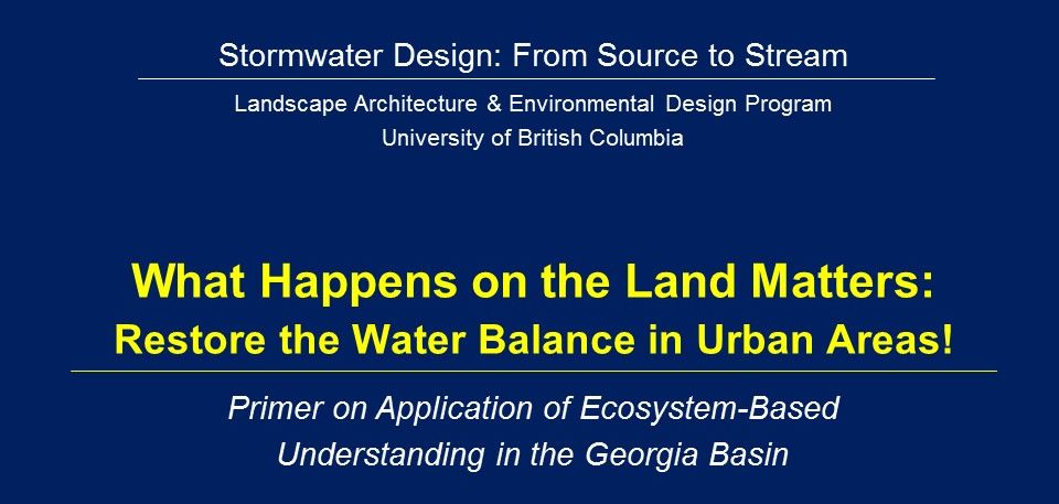
Download What Happens on the Land Matters: Restore the Water Balance in Urban Areas! to view a PDF copy of the complete presentation by Kim Stephens.
Think and Act Like a Watershed: Primer on Application of Ecosystem-based Understanding Connects Past and Current Research
Local governments are starting to recognize that natural assets have value, ecosystem services have a role in municipal service delivery, and so need to be integrated into their asset management programs.
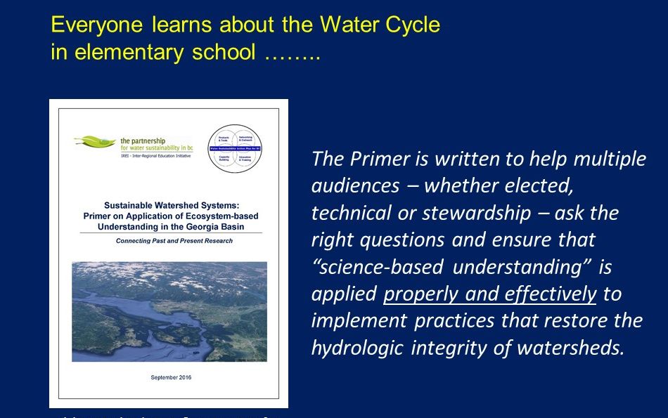
 For these reasons, Sustainable Watershed Systems: Primer on Application of Ecosystem-based Understanding in the Georgia Basin is written in a magazine-style to help multiple audiences – whether elected, administrative, technical or stewardship – ask the right questions and ensure that “science-based understanding” is applied properly and effectively to implement land development practices that restore the water balance (hydrologic integrity) of watersheds.
To Learn More:
Stormwater Design:
From Source to Stream
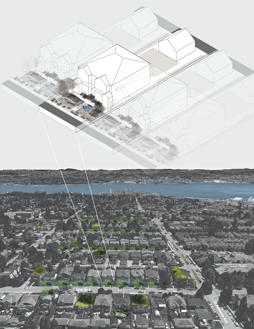
The design studio course taught by Daniel Roehr explores the feasibility, functionality, visual and spatial characteristics and aesthetics of stormwater management strategies and their integration into the urban fabric. For the 2016-2017 academic year, the City of North Vancouver is the case study.
“ The studio has three design phases: In the first students will work individually at the site scale, in the second students work in pairs at urban scale and in the third students work in groups of four at regional scale,” states Daniel Roehr.
“Landscape architecture and architecture students have model making, ‘three-dimensional’ visualization and orthographic drawing skills to explore different sites at different scales, and to demonstrate the aesthetic and spatial experience of rainwater management strategies (size, location and overflow areas on private and public land).”
North Vancouver Case Study
“Over the last fifteen years house sizes have dramatically increased on existing private building lots in the District and City of North Vancouver, as well as driveway sizes,” continues Daniel Roehr.
“The increase in housing size reduces pervious surfaces for rainwater to infiltrate at source into the ground.”
“The quick delivery of additional stormwater in pipes damages nearby streams due to more and faster flowing water from stormwater pipe outfalls, and decreased water quality.”
“The purpose of the case study is to explore two possible scenarios to remedy the situation in single family zones: (1) change zoning to enable taller (two to three storey) buildings on the existing lots while limiting their footprint size; or (2) continue to allow larger building footprints (one to two storeys maximum) on existing lots and add rainwater management features.”
To Learn More:
Download Stormwater Design: From Source to Stream to read the syllabus for the studio design course and City of North Vancouver project.
Drawing by Anezka Gocova 2015