
WBM Express for Landowners: Implementation Recommendation Approved by Cowichan Valley Regional Board in May 2014
Note to Reader:
The Cowichan Valley Regional District (CVRD) is a charter member of the Partnership for Water Sustainability in British Columbia, and a demonstration region for development of the Water Balance Model Express for Landowners (“WBM Express). This web-based tool is an initiative of the Partnership.
In April 2014, Kate Miller (Manager of Environmental Initiatives Division) presented a status report to the CVRD Regional Services Committee. This provided a public platform to announce the launch of the WBM Express for the Cowichan Region. Her presentation included a live demonstration of this decision support tool. To download a copy of her report, click on Staff Report on WBM Express.
Demonstrating Leadership in Watershed Management
 “The CVRD has been a regional case study for the development of the Water Balance Model Express tool for property owners,” wrote Kate Miller in her report to the Regional Services Committee. “This tool has resulted in an enhanced capability of the CVRD to maintain its leadership in the areas of watershed management and the development of technical and community based responses to emerging issues which are appropriate for our regional context.”
In May, the CVRD Regional Board approved the following recommendation by the Regional Services Committee:
That the Water Balance Web Tool and supporting documents be shared with the CVRD and partner municipal planning staff; and further, that planning staff consider integrating the tool into the planning framework to support watershed management objectives at the Official Community Plan level and Development Permit level.
 At the April 2014 meeting of the Regional Services Committee, and following the presentation and discussion period, Ladysmith Mayor Rob Hutchins (the Chair of the Cowichan Valley Regional Board) asked: “Why does the Resolution limit the recommendation to Official Community Plan and Development Permit level rather than to Zoning or Building Permit level as well? Is that an appropriate amendment to make? My question is directed through the Chair to Staff.”
“To be frank,” answered Kate Miller, “my recommendation was framed in such a way so as to not step on toes on the part of either our CVRD planning staff or municipal planning staff. But it certainly could be a recommendation that it would be appropriate to utilize at a variety of scales, most notably at the building scale development scale.”
“So, the way this is phrased, this is a door opener,” observed Mayor Rob Hutchins. “Yes,” replied Kate Miller. Hutchins then moved the motion.
WBM Express is a Tool for Use by the Community
Before leading the Regional Services Committee through a live demonstration of the WBM Express, Kate Miller provided the members with an overview of the considerations behind tool development.
“In our discussions over the last few years around watershed management, one of the things that we have really struggled with is this – how do we provide tools to the community that are really straightforward in terms of demonstrating what we actually means when we say we want your communities to act more like a watershed?,” stated Kate Miller in her opening remarks.
“What we have done with the Water Balance Model Express is develop a clear tool that our communities will be able to use as they develop or redevelop over time. We want folks to understand that stormwater and stormwater management and infrastructure are just a derivative of rain. Stormwater starts as rain. And if we can deal with it at that level on each site, our infrastructure will last longer and it will cost our communities less in terms of direct infrastructure. Also, there will be potentially less damage.”
Significant Engineering is Behind the WBM Express
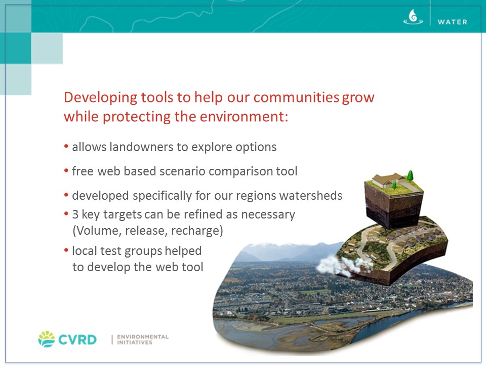
“We have played with this notion of tools. What we have said to the community is that we want you to develop in compact, complete ways,” stated Kate Miller. “We want you to do that based on maintaining the pre and post development watershed balance. What does that mean? Typically it means that we tell them to go and hire an engineer and incur additional costs. We don’t believe that is necessary. And so what you are going to see when I show you the Water Balance Express is what appears to be a very simple model, yet has a phenomenal amount of engineering behind it.”
“We spent a lot of time over the last two years looking at soils, terrain, density, etc. And we developed three key Water Balance targets for each of our watersheds: volume, release rate and a recharge rate. These tell us how much stays on the land, how much needs to run off to protect local stream flow and what actually needs to soak into the ground to move through that narrow lens into the larger watershed.”
“We have gone through a number of iterations. We started off as we all typically do: bright-eyed and bushy-tailed. We envisioned this would be GIS-rich project so that people could zoom in on their property. We stepped back a little bit. We want to make sure it works properly. We have grand plans for Phase 2. To help us we did use a number of local test groups over the last year.”
WBM Express Educates Homeowners on What They Can Do to Protect Stream Health
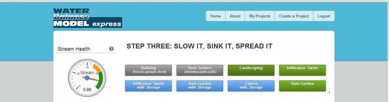
“The Water Balance Model Express has a simple interface that tells you whether you have achieved stream health by doing a number of things effectively on your property,” continued Kate Miller.
“When the user logs-in to the Express, they select the watershed where they live. Then they create a model of their project by clicking and dragging the various elements into place. We have kept it simple with the colour coding: grey means hard surfaces that will shade water off your property; green surfaces such as lawns are neutral; and blue features are those that allow the landowner to store or retain water and slowly release it over time.”
“By playing with these various features, as well as adjusting the different parameters within those features, the user can influence whether or not they are achieving the targets for their property. Once they have done this and they are happy with where the Stream Health dial is sitting, they can print a copy of the report and bring it into the planning department so that it goes on the record in terms of pre and post development runoff for the property,” concluded Kate Miller.
To Learn More:
To download a copy of the report to the Regional Services Committee by Kate Miller, Manager of Environmental Initiatives Division, click on Staff Report on WBM Express.
To download a copy of her supporting PowerPoint slides, click on Linking rainfall stream flow and groundwater as building blocks to healthy watersheds.
To Watch the Video:
Click on http://cvrdmeetings.ca/sirepub/mtgviewer.aspx?meetid=367&doctype=AGENDA (note: the presentation by Kate Miller starts at 51:35 elapsed time).
