
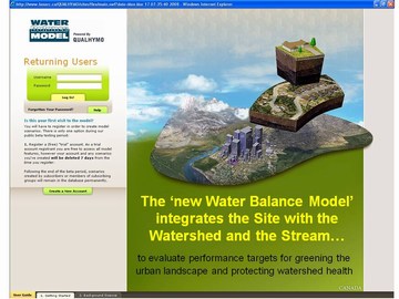
Water Balance Model can create an understanding of the past and compare it to many possible futures
Note to Reader: The following article is adapted from an email trail wherein members of the Water Balance Model team provided an elected representative of a small Vancouver Island city with ‘how to’ guidance regarding use of the Water Balance Model to make informed land development decisions.
How to Establish a Baseline Condition?
The Councillor described the following real-life situation in order to seek guidance on how the municipality could best apply the Water Balance Model as a decision support tool:
- Land is regularly being cleared by land owners before a development permit is sought from the municipality. This practice is creating significant rainwater runoff and impacting negatively on stream values. The debate I find myself in relates to determining the baseline condition.
- Once land clearing has taken place, it has been suggested that a natural state condition cannot be determined. It has been further suggested that Water Balance Model analyses should be based on the ‘current condition’ of the site – that is, ‘pre-development’, and not ‘pre-deforestation’.
The Councillor then posed this question: How can the Water Balance Model be applied to establish performance targets relative to an appropriate baseline condition that is acceptable to the municipality?
A Scenario Comparison Tool
“A key message is that the Water Balance Model is a ‘scenario comparison tool’. In other words, there is no restriction on the scenarios that you may choose to compare,” stated Kim Stephens, Program Coordinator for the Water Sustainability Action Plan for British Columbia.
 “The tool allows you to make transparent ‘what if’ assumptions so that you could in fact compare pre-development and pre-deforestation conditions.”
“A second key message is that it is in the bailiwick of the reviewing agency to apply its best judgment and discretion when deeming what will be an acceptable and/or reasonable baseline condition.”
Create a Vision of the Future Watershed
 “To specifically answer the question, you can start with the forested condition even though some or all of the trees have been removed,” continued Jim Dumont, Engineering Applications Authority for the Inter-Provincial Partnership. “This will provide you with an opportunity to compare what was lost to what might have been, and in so doing allow you to create a vision of the future watershed.”
“For the purposes of a Water Balance Model simulation, the starting scenario can be the watershed in any state, whether that is forested, existing urban, future planning, or just about any condition that you may wish to assess. Yet another key message is that the existing watershed condition should not be seen as a limiting condition; rather, it is just one of many potential conditions.”
“This is where the WBM shines as it is not constrained by starting or ending points. It compares whatever you can envision.”
Water Balance Model Creates Understanding
To illustrate the last point, Jim Dumont described two potential applications that demonstrate the nature of scenario comparison options:
- Example #1: “You could compare a forested watershed to shopping centres, housing, parks, roads, or any mix of the foregoing. The scenarios could include previous engineering standards that would see all the rainwater piped to the stream; OR you can add in any number of rainfall capture techniques for runoff mitigation.”
- Example #2: “You could also compare existing urban mixes to potential future redevelopment changes. The choices for analysis could include: maintain current engineering approaches; apply mixed mitigation works; establish more forested parks or green areas, or whatever. Your imagination is your only limitation.”
“As you can see from these two examples, the Water Balance Model can be a tool to allow you to create an understanding of the past and compare it to many possible futures. This will allow you to see how the watershed can be altered, for good or bad. Then you can create a vision of where you would like to go and how the watershed can meet your vision,” concluded Jim Dumont.
About Jim Dumont:
“The Inter-Provincial Partnership named Jim Dumont as our Engineering Applications Authority because he is a recognized specialist in hydrologic modelling. Jim Dumont is a leader in his field,” states Ted van der Gulik, Chair.
“The Engineering Applications Authority is responsible for developing and/or overseeing development of the hydrology applications and stream health methodologies that enhance the Water Balance Model as a scenario modeling and decision support tool for use at the site, neighbourhood and watershed scales.”
To learn more about Jim Dumont, click on Inter-Provincial Partnership names Jim Dumont as the Engineering Applications Authority for the Water Balance Model.

Posted March 2010